

Sale, Richard.
Softback version, first edition. 8vo (246 x 189mm). Text vol: pp. 208; 16pp. colour photo. illusts., numerous black and white images as well as reproductions of entries from Pundit diaries and pages from Michael Ward’s diaries of his 1951 Everest reconnaissance expedition, and his 1964 and 1965 Bhutan expeditions; original limp card wrappers, new. Map case: 44 maps of all the Pundit journeys, the first time they have ever been collected together, as well as maps illustrating the debate over whether the Tibet Tsangpo river became India’s Brahmaputra or Burma’s Irawaddy (a debate which led to several Pundit journeys); maps of the Everest region and northern Bhutan based on Michael Ward’s survey work are also included; all housed in a purpose-made slipcase. The text volume and map case are both housed in a card slipcase.
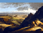
This book, begun by Michael Ward (of the 1951 and 1953 Everest expeditions), was completed following Michael Ward's death by Richard Sale. The book has a Preface written by Michael Ward, intended to begin the work he had planned on the Pundits. The book keeps to Michael Ward's original plan: It begins with details of early journeys made by Europeans to the Himalayan kingdoms of Afghanistan and its neighbouring emirates, Tibet, Nepal and Bhutan, before moving on to the work of the Survey of India and the Great Game, these being precursors to the work of the Pundits. The Pundits are then covered individually, with such biographical information as is known and details of the their journeys. Michael Ward was interested in both the work of the Pundits and their techniques. During his involvement with the 1951 Everest Reconnaissance expedition, while he did not use Pundit techniques, he did carry out some survey work, the results of which were incorporated into maps of the region. Later, on two trips to Bhutan as a medical advisor to the king, he was given permission to trek in the remote Lunana district and used Pundit techniques to prepare the first accurate map of the area. The two chapters on Michael Ward's time on Everest in 1951 and Bhutan in 1964 & 1965 draw extensively on his diaries for these trips, making available information for the 1951 Everest expedition not published before, and reproducing survey maps that Ward produced on these occasions.